Milestones & Boundary Markers


Some images of some local Milestones & Boundary Markers – see also Photographs of Local Milestones & Boundary Markers
- Photo #1:
Milestone outside The Royal Oak on Clare Road, Halifax.
- Photo #2:
This stone stands at the top of Water Hill Lane, Warley
- Photo #3:
This stone stands at the top of Dark Hill Lane, Warley
- Photo #4:
This stone stands at Friendly
- Photo #5:
This stone stands at Willowfield, Burnley Road
- Photo #6:
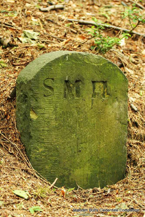
This is one of a number of similar stones which stand in Southowram Bank, just below the site of St Michael & All Angels Church .
- Photo #7:
A milestone on the Leeds-Elland Road at Clifton
- Photo #8:
The Milestone at St Luke's Church, Norland
- Photo #9:
Guide stone at Law Lane, Southowram
Milestone outside The Royal Oak on Clare Road, Halifax.
It is badly eroded and records
To London 198
To Huddersfield 7
This image [DG54.JPG] was kindly submitted by David Greaves


This stone stands at the top of Water Hill Lane, Warley
with its junction with Blackwall Lane, Sowerby Bridge.
It marks the boundary between Warley and Luddendenfoot
This image [DG276.JPG] was kindly submitted by David Greaves


This stone stands at the top of Dark Hill Lane, Warley
with its junction with Butts Green Road / Great Edge Warley.
It marks the boundary between Warley and Luddendenfoot
This image [DG277.JPG] was kindly submitted by David Greaves


This stone stands at Friendly
near the White Horse Inn – 9 miles to Todmorden, 2¾
miles to Halifax
This image [DG347.JPG] was kindly submitted by David Greaves


This stone stands at Willowfield, Burnley Road
near the old Willowfield Hall
- 10 miles to Todmorden, 1¾ miles to Halifax
This image [DG393.JPG] was kindly submitted by David Greaves


This is one of a number of similar stones which stand in Southowram
Bank, just below the site of St Michael & All Angels
Church.
They are all inscribed with the letters SM followed by another
letter.
This one has SMH
and is possibly a boundary marker between Southowram
and Halifax
or between St Michael's and Halifax
This image [DP4.JPG] was kindly submitted by Darrell Prest


A milestone on the Leeds-Elland Road at Clifton
[Taken in June 2010]


The Milestone at St Luke's Church, Norland
with the graveyard and Norland Church of England Junior & Infant
School in the background


Guide stone at Law Lane, Southowram
[Taken in June 2013]

©
Malcolm Bull
2025
Revised 12:37 / 15th July 2025 / 8119
Page Ref: PH811


